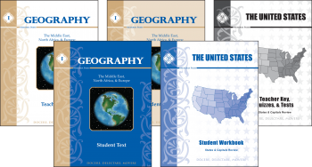
- Geography I: Middle East, North Africa, and Europe $14.95
- Geography I: Middle East, North Africa, and Europe Student Workbook $11.95
- Geography I: Middle East, North Africa, and Europe Teacher Guide $12.95
- United States Student Workbook $5.00
- United States Teacher Key, Quizzes, and Tests $7.95
Geography I: Middle East, North Africa, and Europe Student Text (103 pages), is a student text for daily reading. It begins with a page of teaching guidelines, which recommend covering 2-3 countries per week. This book goes well with the Geography I: Middle East, North Africa, and Europe Student Workbook (90 pages). As they read the one page in the text on each country, they can test their knowledge by filling in the blanks in the workbook. If you have more than one student, you can share the text and purchase extras of the consumable workbook. I think they are very reasonably priced for this!
The text begins with an introduction on geography (2 pages) and then moves right into each of the countries covered. This edition covers:
The Middle East
- Israel
- Jordan
- Syria
- Lebanon
- Iraq
- Iran
- Turkey
- Saudi Arabia
- Pakistan
- Afghanistan
North Africa
- Egypt
- Sudan
- Libya
- Tunisia
- Algeria
- Moroco
and Europe
- Mediterranean Europe: Greece, Italy, Spain, Portugal, France
- Central Europe: Switzerland, Austria, Germany, Netherlands, Belgium
- The British Isles and Low Countries: United Kingdom, Ireland
- Scandinavia: Norway, Sweden, Denmark, Iceland, Finland
- Eastern Europe: Russia, Baltic States, Belarus and Ukraine, Poland, Czech Republic and Slovakia, Hungary, Romania, Bulgaria, Albania, The Balkans
Finally, in the back of the book are full color flags for the kids to reference for the countries (The text is only two colors: black and blue) For each country there is a page of text covering the history (both ancient and recent) and some fast facts like: land-forms, major cities, flag, languages, capital city, climate, and resources. Then there is a full page map showing major political boundaries and bodies of water. There are a few geographical features noted, but this is not a detailed map.
The Geography I: Middle East, North Africa, and Europe Teacher Guide (131 pages) follows the text through each of these same countries, with the answers filled in the blanks of the workbook pages. It does break the European countries into the following sub-categories: Mediterranean Europe, Central Europe, The British Isles and Low Countries, [Review of Europe pt 1], Scandinavia, Eastern Europe I, Eastern Europe II, [Review Scandinavia and Eastern Europe], [Review Europe]. In the back of this book are (copy-able for multiple use) quizzes and tests and their answer keys. The Student Workbook mirrors these categories and reviews.
The United States Student Workbook (25 pages) and United States Teacher Key, Quizzes, and Tests (95 pages) are only a workbook and key for reviewing the text of their United States Curriculum (Not included in Geography I; geared for grades 4-6). We had not used that curriculum, but we did use it to review our studies in states and capitals from last year. It is broken into 4 sections, with 8 weeks (8 regions) of review for each section. The sections include:
- Naming states in each region on a blank region map
- Matching capital names to state names
- Matching capitals to their states on a blank region map
- Naming states and their capitals on a blank region map
The final review is filling in blanks of capitals for each state, then filling in blanks of states for each capital. This entire review is spaced out for a once a week activity for an entire traditional school year (32-36 weeks).
How we used it:
We made a goal of covering one country per day in the text, 2-3 days per week. It was easy to sit down and read it together. I used this primarily for my 4th grade daughter, Emma, but Tyler (5th grade) enjoyed it too. We would then fill in the blanks on the workbook, and discuss the flag and map. It took only about 20-30 minutes per day to complete, and we had no trouble covering the Middle East section during the review period. Each day we also reviewed the regional map of the Middle East and the kids can now name each and every country on that map. This is SO important to me, especially considering current events in the news. We used the first section of the US States Review book as well.
What I liked:
- This is a straightforward approach to a good geography overview of this region of the world.
- The text is not too long and the facts are easy to retain.
- The instructions are simple to follow and I was not lost on how to teach it.
- The quizzes and tests in the teacher guide are reproducible for multiple students within the home, so I need only buy more workbooks.
- The workbooks are reasonably priced!
- The ancient history part focuses on ways these countries tie in with Bible history, where applicable.
- The text is age appropriate and reads easily at a 4th grade level.
- The paper is of a quality weight, and the soft-covers seem pretty durable.
- The way it is already broken up into a schedule for a traditional school year.
What I didn't like:
- This focuses mostly on political borders and not so much on topographical features. This means the text will be outdated more easily as some regions undergo constant political change. This would somewhat negate the value of buying a text and teacher guide and using new workbooks for all of your up-coming students as they pass through this grade.
- All of the illustrations are black and white, with the exception of the flags in the back of the student text-book.
 Bottom Line:
We liked this curriculum very well. It doesn't have a lot of frills but it gets the job done! The kids easily picked up the country names and were quickly able to name everything in the region. We plan to continue using these books throughout the coming school year. The value of what you get for your $ can't be beat!
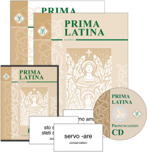
But don't just take my word for it. :) Please read other reviews of Geography I or of Prima Latina (see image right), also from Memoria Press, by visiting the crew blog here:

©2012-2013 Loving and Learning on the High Plains. All rights reserved. All text, photographs, artwork, and other content may not be reproduced or transmitted in any form without the written consent of the author. http://www.homeschoolhighplains.blogspot.com

*Prices and links are accurate at the time this is published, and are subject to change.


Thanks so much for alerting me to the fact of the incorrect linky. Have a great weekend.
ReplyDeleteBlessings
Diane